Tracking Running Route with GPS
1. Intro
In the last UBER post, we looked at uber rides which triggered me to analyze GPS data.
As usual, I went on a little scanvenger hunt and stumbled upon a running history dataset uploaded by a Ph. D candidate majoring in Linguistics. I politely asked him if I can analyze the data and post it on my blog, and he was very kind to give me permission. HUGE tahnks to Mr. Sascha Wolfer! Below is a snapshot of the email I received from him:

2. Data
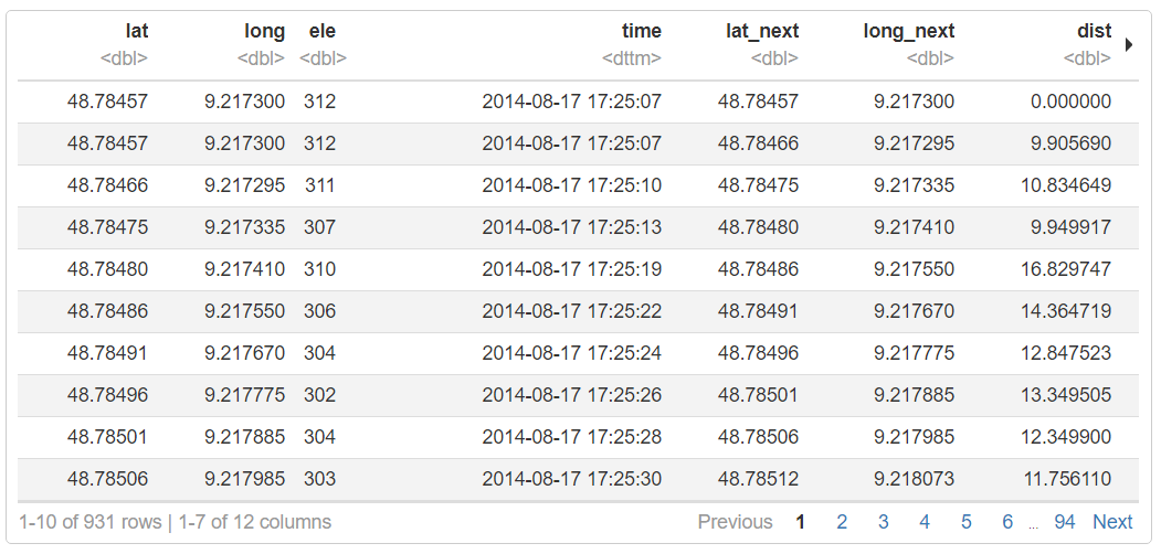
The files was in XML format with GPS data schema (GPX). I added a few variables (distance, time, speed, etc.) for the purpose of our analysis.
Sassha’s location (lat,long), speed (speed_km_per_hour), and elevation is collected in our dataset accordingly with time stamps time.
3. Visualization
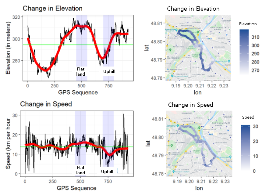
- The green line indicates the mean value.
- On a flatland, the speed follows the overall mean speed.
- In the uphill, we can observe that Sassha slowed down then made the last spurt.
- At the end, Sassha probably ran out of energy and fell short of the overall mean speed.
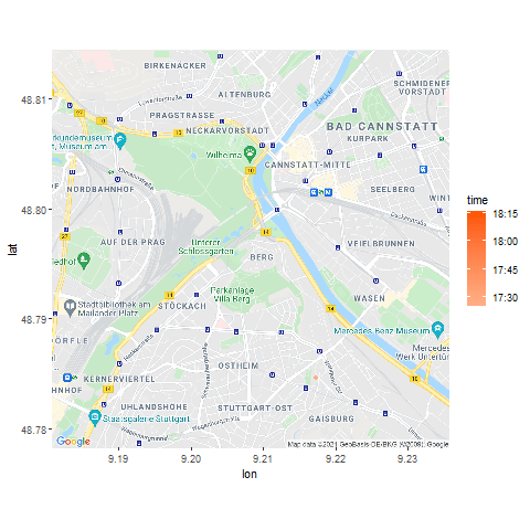
Below is a time series animation of the run:
4. In Retrospect
Since the visualization of storm data using ELK Stack, it’s been a while I have not analyzed GPS data. This project made me wonder how UBER and SOCAR (a car-sharing startup in South Korea) would use their GPS data.
As for SOCAR:
- They might track each driver’s driving habit and reflect that on their insurance fee. However, GPS is not really an accurate measure if they want to look at how fast the driver is turning at corners or how often he/she is making a sudden acceleration or stop. SOCAR might collect those data through installation of accelerometer sensors.
- How cool would it be if I collect my own GPS data and analyze it!? Recently, some of my friends shared thier running track and result collected via NIKE app. One day, I’d like to track myself playing soccer and create a heatmap or statistics of my playing style.
Fun Fact: GPS (Global Positioning System) was started by the U.S. Department of Defense in 1973 to increase the accuracy of its missiles. It was later open to civilian use in the 1980s following an executive from President Reagan after the Korean Air Lines Flight 007 incident. Civilians first used it to improve routes for ships and airplanes, it was not until 2000s GPS was implemented in car navigation system. It’s ironic that the technology originally crafted for military force has become such a ubiquitous and yet invaluable technology in our lives today.